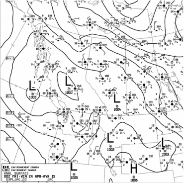
This event on the 29th turned out to be the last one of the project. Stephen Berg was our forecaster for the day giving us a heads up the night before. NAM and RAP were predicting light precipitation around 12 UTC while the GFS had things starting a little earlier around 09 UTC. On the other hand the GEM had been predicting precipitation around 18 UTC.
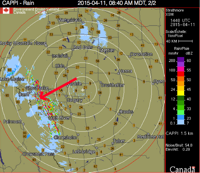
We arrived on site with very light rain around 1230 UTC after a check on the radar at 1200 UTC showing a small precip band to the North. Lucia and myself quickly headed out to Fortress Mountain to conduct the first carsonde of the day.
Around 1900 UTC another line was situated over Banff oriented NNE to SSW, mostly to the North of Banff and propagating Eastward.
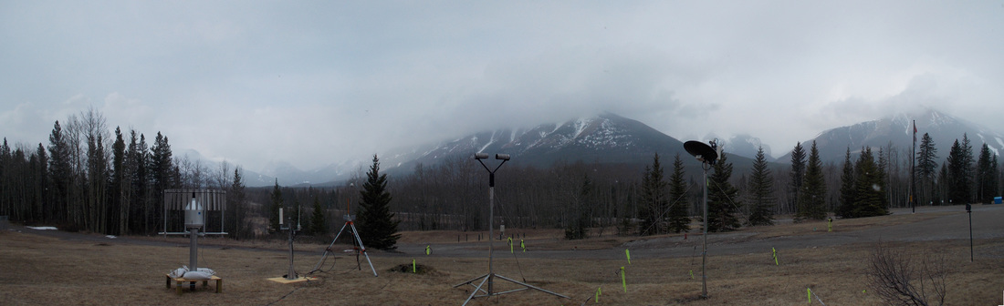
A second carsonde was conducted by Lucia and myself in search of a transition line up Fortress Mountain. We were sure to check the very last radar scan while we still had cell service on the drive to Fortress. About three quarters up to the top, we noticed small solid particles within the raindrops hitting our windshield, marking our transition line. At the top, we found mixed precipitation, which slowly changed into solid precipitation, mostly in the form of graupel, though towards the end we did notice some rimed snowflakes. We attempted taking pictures every 5 minutes, but because the snowfall wasn't always consistent, we just tried getting as many snowflake photo samples as possible. We went down while there was still solid precipitation at the top and headed down in search of the transition zone. The transition zone was not so clear cut. There were times where there seemed to be more rain, then a minute later we noticed more snow. Eventually we did find the end of the transition zone when it was all clearly rain.
When we arrived back at KES, the precipitation had ended.
We arrived on site with very light rain around 1230 UTC after a check on the radar at 1200 UTC showing a small precip band to the North. Lucia and myself quickly headed out to Fortress Mountain to conduct the first carsonde of the day.
Around 1900 UTC another line was situated over Banff oriented NNE to SSW, mostly to the North of Banff and propagating Eastward.
A second carsonde was conducted by Lucia and myself in search of a transition line up Fortress Mountain. We were sure to check the very last radar scan while we still had cell service on the drive to Fortress. About three quarters up to the top, we noticed small solid particles within the raindrops hitting our windshield, marking our transition line. At the top, we found mixed precipitation, which slowly changed into solid precipitation, mostly in the form of graupel, though towards the end we did notice some rimed snowflakes. We attempted taking pictures every 5 minutes, but because the snowfall wasn't always consistent, we just tried getting as many snowflake photo samples as possible. We went down while there was still solid precipitation at the top and headed down in search of the transition zone. The transition zone was not so clear cut. There were times where there seemed to be more rain, then a minute later we noticed more snow. Eventually we did find the end of the transition zone when it was all clearly rain.
When we arrived back at KES, the precipitation had ended.


 RSS Feed
