We arrived on site at April 11 at 1300 UTC with the storms commencing around 1330 UTC. This event was a bit of an odd case, as it was intermittent up until the following day. Throughout the event, snowfall was anywhere from moderate to very very light, however it was predominantly very light snow or no snow at all. No rain was observed at the site during the entirety of the event.
Snowflake photo taking was difficult as the temperatures at KES were above zero, however we did observe and note that at times particles were moderately to heavily rimed. After our first wave, we noticed chinook like conditions at the site, with temperatures increasing and the air drying. During a break in the storm, when photos could not be taken at KES, Ida, Dominic and Housseyni conducted a carsonde at Fortress Mountain. They did not observe any snow-rain transition line on the way up, but were able to snowflake pictures at the top where snowfall was heavy. The kestrel values were appropriate and not changing rapidly as we had witnessed a few days before. This is perhaps due to the strong winds atop Fortress.
Majority of the storms that tracked in our direction came from the NW, popping up around Lake Louise and Banff before hitting KES. What seemed to be a strong line of snowfall would either weaken or completely dissipate by the time it crossed the mountains from Banff to KES - donut hole effect.
The waves of precipitation continued on till the following day, ending in the afternoon, however snow was meek at best, usually only very very light snowfall, which the parsivel observed as no precipitation.
Field site participants - Ida, Dominic, Melissa, Housseyni & Juris
Instruments working - MRR, parsivel, Geonor, weather station, sounding system
- Juris Almonte
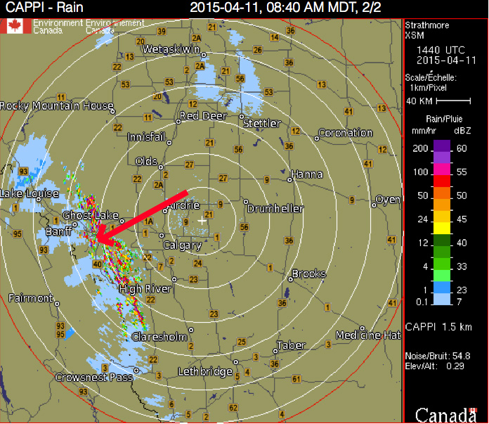
Storms around us.
 RSS Feed
